
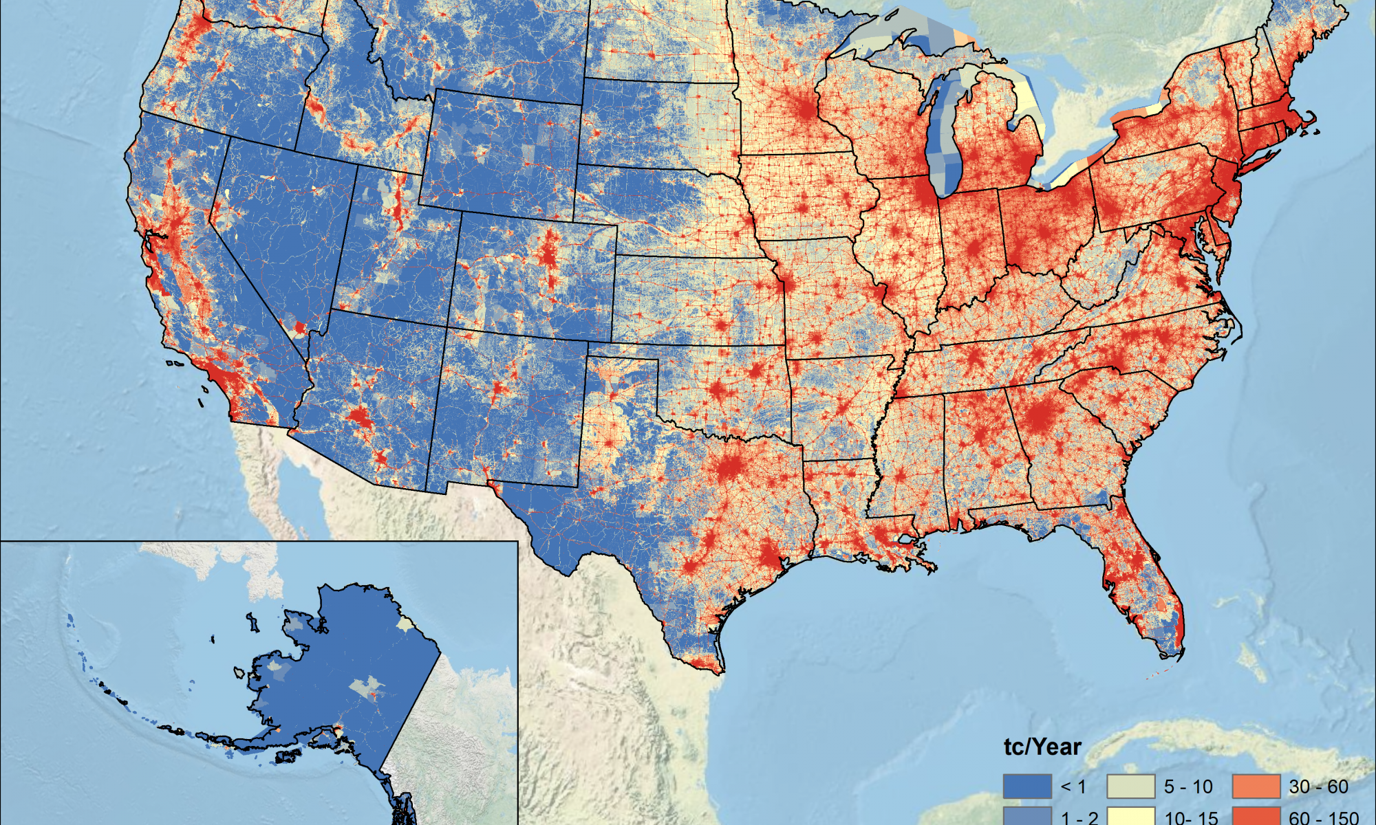
Professor Kevin Gurney’s research group has released the Vulcan version 3.0 dataset and an accompanying paper in the Journal of Geophysical Research: Atmospheres. The Vulcan version 3.0 dataset estimates carbon dioxide emissions from fossil fuel combustion (FFCO2) for the entire United States at a 1 km, hourly resolution from 2010 to 2015 along with emissions sources. Vulcan estimates FFCO2 emissions of 1,589.9 TgC in 2011. Vehicles and commercial/residential buildings contribute contribute a higher percentage of FFCO2 emissions in densely populated states. Meanwhile, less densely populated states had more of their emissions coming from electricity generation and industrial activity. These less densely populated states also had higher per capita emissions. The Vulcan v3.0 data product is available at annual and hourly temporal resolution. These data are already being used by scientists around the world to understand urban greenhouse gas budgets and the impacts of COVID-19 shutdowns on CO2 emissions. The hourly dataset is more than 11 TB and the production and uploading of these data were supported by NAU’s High Performance Computing center.
You can find more information here. Watch the animation below!